Navigation
NP231 - ADMIRALTY Guide to the Practical use of ENCs
£112.90
NP231 - ADMIRALTY Guide to the Practical use of ENCs
Passage Planning Guide, Baltic: Danish Straits - (PPG - Baltic, 2025-26 Edition)
£325.00
This publication is an essential resource for ships navigating the Danish Straits and provides guidance to aid Masters and navigating officers in the creation of passage plans for the transit. The guidance applies in either direction through the Straits via the Great Belt and the Sound and includes an overview of the navigational references for each leg of the routes. In cooperation with DanPilot and BIMCO, this new edition has been fully revised to incorporate the latest guidance and practical advice for ships transiting the region, with reference to important information such as pilotage, anchorages, reporting requirements and traffic.
Passage Planning Guidelines, 2025 Edition
£325.00
Stock due in April 2025. Passage Planning Guidelines 2025 - (Incorporating Radar and ARPA, Safe Nav Watch and Teamwork on the Nav Bridge)
NP323 - ADMIRALTY: Star Finder and Identifier
£22.90
NP323 - ADMIRALTY: Star Finder and Identifier
NP120 - Admiralty: Manual of Tides
£112.90
NP120 - Admiralty: Manual of Tides
NP232 - ADMIRALTY Guide to ECDIS Implementation, Policy and Procedures
£112.90
NP232 - ADMIRALTY Guide to ECDIS Implementation, Policy and Procedures
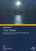
NP208 - ADMIRALTY Tide Tables: South East Atlantic Ocean (2025)
£45.30
NP208 - ADMIRALTY Tide Tables: South East Atlantic Ocean (2025)
NP255 - ADMIRALTY Tidal Stream Atlas: Falmouth to Padstow (Including Isles of Scilly)
£22.99
NP255 - ADMIRALTY Tidal Stream Atlas: Falmouth to Padstow (Including Isles of Scilly)
NP254 - ADMIRALTY Tidal Stream Atlas: Falmouth to Teignmouth
£22.99
NP254 - ADMIRALTY Tidal Stream Atlas: Falmouth to Teignmouth
NP253 - ADMIRALTY Tidal Stream Atlas: North Sea - Eastern Part
£22.99
NP253 - ADMIRALTY Tidal Stream Atlas: North Sea - Eastern Part
NP252 - ADMIRALTY Tidal Stream Atlas: North Sea - North Western Part
£22.90
NP252 - ADMIRALTY Tidal Stream Atlas: North Sea - North Western Part


